|
Fernie trail map is available as part of our USA/Canada Ski App. It is supported on iPhone / iPad, Android, Windows 8 Phone and Blackberry.
Fernie Alpine Resort is a ski resort, located on Lizard Range, near the town of Fernie, British Columbia in Canada. It is known particularly for its high annual snowfall, reportedly the highest of any...(From Wikipedia page of Fernie Ski Resort).
Want to know what others are saying about our app? Go here to see our reviews and coverage. This app is available as part of USA/Canada Ski App package to suit your skiing needs. Have more questions about the Ski App? Ask us.
|
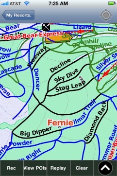 Fernie: Gps Ski Maps - iPhone Ski App |
||||||||||||||||||||||||
Fernie users
| Ski Resort | Type | Info | Date |
|---|---|---|---|
| Fernie | Track | 10 runs, max 23.75 m/s, avg 6.20 m/s, 1 green, 40 blue, 10 black, Tracked on App | Friday, March 6th, 2015 |
| Fernie | Track | 4 runs, max 16.0 m/s, avg 4.40 m/s, 2 green, 16 blue, 2 black, Tracked on App | Wednesday, February 4th, 2015 |
| Fernie | Track | 7 runs, max 16.0 m/s, avg 4.77 m/s, 10 green, 17 blue, 1 black, Tracked on App | Sunday, February 1st, 2015 |
| Fernie | Track | 5 runs, max 13.25 m/s, avg 3.93 m/s, 21 green, 9 blue, Tracked on App | Friday, January 30th, 2015 |
| Fernie | Track | 9 runs, max 13.5 m/s, avg 5.57 m/s, 26 green, 7 blue, Tracked on App | Friday, January 30th, 2015 |