Heavenly Ski App


Heavenly trail map is available as part of our USA/Canada Ski App. It is supported on iPhone / iPad, Android, Windows 8 Phone and Blackberry.  

Heavenly Mountain Resort is a ski resort located on the California-Nevada border in South Lake Tahoe. It has 97 runs and 30 lifts that are spread between California and Nevada and four base facilities...(From Wikipedia page of Heavenly Ski Resort).
 When you purchase our Ski App,  you get all the great ski app features, along with Heavenly gps ski map.


Want to know what others are saying about our app? Go here to see our reviews and coverage.

This app is available as part of  USA/Canada Ski App package to suit your skiing needs.

Have more questions about the Ski App? Ask us.


Heavenly Ski Stats
LocationEl Dorado-Toiyabe National ForestsEl Dorado County, California / Douglas County, Nevada
Nearest citySouth Lake Tahoe, California
Coordinates38°56′07″N 119°56′24″W / 38.9353°N 119.9400°W / 38.9353; -119.9400Coordinates: 38°56′07″N 119°56′24″W / 38.9353°N 119.9400°W / 38.9353; -119.9400
Vertical3,812 ft (1,162 m)
Top elevation10,067 ft (3,068 m)
Base elevation6,255 ft (1,907 m)
Skiable area4,800 acres (1,900 ha)
Runs97 total 20% beginner 45% intermediate 35% advanced
Longest run5.5 mi (8.9 km) (Olympic)
Lift system30 total: 1 high speed gondola, 1 high speed aerial tram, 2 high speed six passenger chairs, 7 high speed quads, 1 quad, 5 triples, 3 doubles, 6 surface, 4 magic carpets
Terrain parks5: Groove, Powderbowl, Cascade, High Roller, Nightlife
Snowfall360 in (910 cm)
SnowmakingYes
Night skiingNo
Web sitewww.SkiHeavenly.com


Heavenly ski map - iPhone Ski App
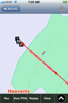
Heavenly: Gps Ski Maps - iPhone Ski App

Heavenly users

Ski ResortTypeInfoDate
HeavenlyTrack13 runs, max 16.709999 m/s, avg 1.86 m/s, 38 blue, 5 black, Tracked on AppSaturday, March 28th, 2015