|
Hunter Mountain trail map is available as part of our USA/Canada Ski App. It is supported on iPhone / iPad, Android, Windows 8 Phone and Blackberry.
Hunter Mountain is a ski resort located about three hours up the New York State Thruway (I-87) north-northwest of New York City. It features a 1,600-foot (488 m) vertical drop.(From Wikipedia page of Hunter Mountain Ski Resort).
Want to know what others are saying about our app? Go here to see our reviews and coverage. This app is available as part of USA/Canada Ski App package to suit your skiing needs. Have more questions about the Ski App? Ask us.
|
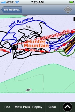 Hunter Mountain: Gps Ski Maps - iPhone Ski App |
||||||||||||||||||||||||||||