|
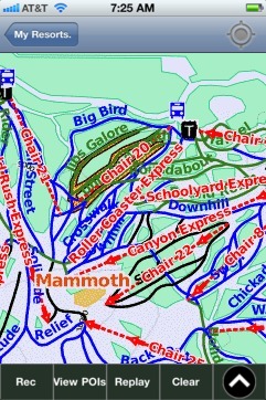
Mammoth trail map is available as part of our USA/Canada Ski App. It is supported on iPhone / iPad, Android, Windows 8 Phone and Blackberry.
Mammoth Mountain Ski Area is a large ski resort located in Eastern California, along the east side of the Sierra Nevada mountain range in the Inyo National Forest. It is also the owner and operator of...(From Wikipedia page of Mammoth Ski Resort).
Want to know what others are saying about our app? Go here to see our reviews and coverage. This app is available as part of USA/Canada Ski App package to suit your skiing needs. Have more questions about the Ski App? Ask us.
|
 Mammoth: Gps Ski Maps - iPhone Ski App |
||||||||||||||||||||||||||||||||||
Mammoth users
| Ski Resort | Type | Info | Date |
|---|---|---|---|
| Mammoth | Track | 3 runs, max 19.25 m/s, avg 8.26 m/s, 10 blue, 4 black, Tracked on App | Friday, May 15th, 2015 |
| Mammoth | Track | 3 runs, max 15.25 m/s, avg 3.22 m/s, 8 blue, 3 black, Tracked on App | Friday, May 15th, 2015 |