|
Mission Ridge trail map is available as part of our USA/Canada Ski App. It is supported on iPhone / iPad, Android, Windows 8 Phone and Blackberry.
Mission Ridge Ski Area is a ski area located near Wenatchee, Washington. The base elevation is at 4570 feet (1393 m) with the peak at 6820 feet (2079 m). Mission Ridge receives an average of 200 inche...(From Wikipedia page of Mission Ridge Ski Resort).
Want to know what others are saying about our app? Go here to see our reviews and coverage. This app is available as part of USA/Canada Ski App package to suit your skiing needs. Have more questions about the Ski App? Ask us.
|
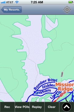 Mission Ridge: Gps Ski Maps - iPhone Ski App |
||||||||||||||||||||||||||||||||