|
Mount Seymour is a mountain located in Mount Seymour Provincial Park in the District of North Vancouver, British Columbia. It is a part of the North Shore Mountains, rising to the north from the shore...(From Wikipedia page of Mount Seymour, BC Ski Resort).
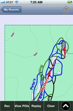
When you purchase our Ski App, you get all the great ski app features, along with Mount Seymour, BC gps ski map.
Want to know what others are saying about our app? Go here to see our reviews and coverage.
This app is available as part of USA/Canada Ski App package to suit your skiing needs.
Have more questions about the Ski App? Ask us.
| Mount Seymour, BC Ski Stats | | Elevation | 1,449 m (4,754 ft) | | Prominence | 453 m (1,486 ft) | | Location | British Columbia, Canada | | Range | Fannin Range | | Coordinates | 49°23′36″N 122°56′40″W / 49.39333°N 122.94444°W / 49.39333; -122.94444Coordinates: 49°23′36″N 122°56′40″W / 49.39333°N 122.94444°W / 49.39333; -122.94444 | | Topo map | NTS 92G/07 | | First ascent | 1908 C. Chapman; B. Darling; W. Gray; G. Harrow; R. Mills | | Location | British Columbia, Canada | | Nearest city | North Vancouver, 15 km (9 mi) | | Coordinates | 49°23′46″N 122°56′40″W / 49.39611°N 122.94444°W / 49.39611; -122.94444 (Mount Seymour Ski Area) | | Vertical | 330 m (1,083 ft) | | Top elevation | 1,265 m (4,150 ft) | | Base elevation | 935 m (3,068 ft) | | Skiable area | 200 acres | | Runs | 23 total 22% beginner 61% intermediate 17% expert | | Longest run | 1.6 km (1 mi) | | Lift system | 5 total 1 high speed detachable quad 2 double chairlifts 2 magic carpets | | Snowfall | 1,200 cm (472 in) | | Web site | Mt. Seymour |
|
Mount Seymour, BC: Gps Ski Maps - iPhone Ski App |