Powder Mountain Ski App


Powder Mountain trail map is available as part of our USA/Canada Ski App. It is supported on iPhone / iPad, Android, Windows 8 Phone and Blackberry.  

2800 acres (11.33 km²) lift-served --(From Wikipedia page of Powder Mountain Ski Resort).
 When you purchase our Ski App,  you get all the great ski app features, along with Powder Mountain gps ski map.


Want to know what others are saying about our app? Go here to see our reviews and coverage.

This app is available as part of  USA/Canada Ski App package to suit your skiing needs.

Have more questions about the Ski App? Ask us.


Powder Mountain Ski Stats
LocationCache / Weber counties, Utah, USA
Nearest cityEden, Utah 7 miles (11 km) south, Ogden, Utah 19 miles (31 km) southwest, Salt Lake City, Utah 55 miles (89 km) south
Coordinates41°22′48″N 111°46′49″W / 41.38000°N 111.78028°W / 41.38000; -111.78028 (Powder Mountain)
Vertical2000 ft (610 m) lift-served -- 2522 ft (769 m) via snowcat
Top elevation8900 ft (2713 m) lift-served -- 9422 ft (2872 m) via snowcat
Base elevation6900 ft (2103 m)
Skiable area2800 acres (11.33 km²) lift-served -- 7200 acres skiable area
Runs144
Longest run3 mi (4.8 km)
Lift system4 chairs, 3 surface lifts
Lift capacity6350 skiers/hr
Terrain parks2
Snowfall350 in./year (8.9 m/year)
Snowmakingnone
Night skiing1 chair, 1 surface lift, 7 days a week
Web sitePowder Mountain Winter Resort


Powder Mountain ski map - iPhone Ski App
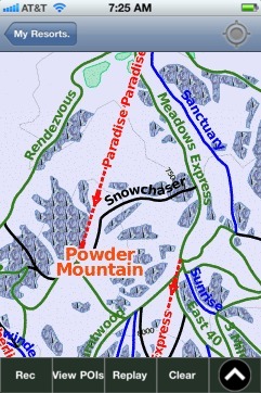
Powder Mountain: Gps Ski Maps - iPhone Ski App

Powder Mountain users

Ski ResortTypeInfoDate
Powder MountainTrack7 runs, max 27.268343 m/s, avg 6.63 m/s, 16 green, 4 blue, 1 black, Tracked on AppThursday, April 23rd, 2015