|
Revelstoke, BC trail map is available as part of our USA/Canada Ski App. It is supported on iPhone / iPad, Android, Windows 8 Phone and Blackberry.
Revelstoke Mountain Resort (RMR) is a ski resort on Mount Mackenzie, just outside Revelstoke, British Columbia in Canada.(From Wikipedia page of Revelstoke, BC Ski Resort).
Want to know what others are saying about our app? Go here to see our reviews and coverage. This app is available as part of USA/Canada Ski App package to suit your skiing needs. Have more questions about the Ski App? Ask us.
|
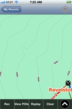 Revelstoke, BC: Gps Ski Maps - iPhone Ski App |
||||||||||||||||||||||||||
Revelstoke, BC users
| Ski Resort | Type | Info | Date |
|---|---|---|---|
| Revelstoke, BC | Track | Tracked on App | Wednesday, December 10th, 2014 |
| Revelstoke, BC | Track | Tracked on App | Monday, December 1st, 2014 |