Snowshoe, WV Ski App


Snowshoe, WV trail map is available as part of our USA/Canada Ski App. It is supported on iPhone / iPad, Android, Windows 8 Phone and Blackberry.  

Snowshoe Mountain is a ski resort in Snowshoe, West Virginia. The resort has skiable terrain across 244 acres (98.74 ha) and covers a total area of 11,000 acres (4,452 ha) in the Allegheny Mountains...(From Wikipedia page of Snowshoe, WV Ski Resort).
 When you purchase our Ski App,  you get all the great ski app features, along with Snowshoe, WV gps ski map.


Want to know what others are saying about our app? Go here to see our reviews and coverage.

This app is available as part of  USA/Canada Ski App package to suit your skiing needs.

Have more questions about the Ski App? Ask us.


Snowshoe, WV Ski Stats
LocationPocahontas County,West Virginia
Nearest cityMarlinton and Lewisburg to the southElkins to the north
Coordinates38°24′32″N 79°59′41″W / 38.40889°N 79.99472°W / 38.40889; -79.99472 (Snowshoe Mountain)
Vertical1,500 feet (457 meters)
Top elevation4,848 feet (1,478 meters)
Base elevation3,348 feet (1,020 meters)
Skiable area244 acres (98.74 hectares)
Runs60
Longest run1.5 miles (2.4 kilometers)
Lift system14 chairlifts
Lift capacity23,400 skiers per hour
Snowfall180 inches (457 centimeters) (per year)
Snowmaking100%
Night skiingat the Silver Creek area
Web sitesnowshoemtn.com


Snowshoe, WV ski map - iPhone Ski App
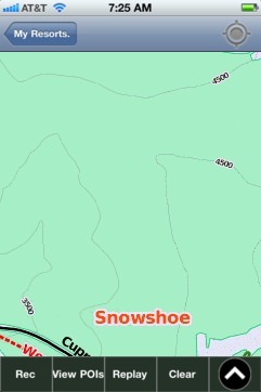
Snowshoe, WV: Gps Ski Maps - iPhone Ski App