|
Solitude trail map is available as part of our USA/Canada Ski App. It is supported on iPhone / iPad, Android, Windows 8 Phone and Blackberry.
Solitude Mountain Resort is a ski resort located in the Big Cottonwood Canyon of the Wasatch Mountains, thirty miles southeast of Salt Lake City, Utah. With 64 trails, 1,200 acres (4.9 km2) and 2,047...(From Wikipedia page of Solitude Ski Resort).
Want to know what others are saying about our app? Go here to see our reviews and coverage. This app is available as part of USA/Canada Ski App package to suit your skiing needs. Have more questions about the Ski App? Ask us.
|
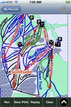 Solitude: Gps Ski Maps - iPhone Ski App |
||||||||||||||||||||||||||||||