|
Tremblant trail map is available as part of our USA/Canada Ski App. It is supported on iPhone / iPad, Android, Windows 8 Phone and Blackberry.
Mont Tremblant Ski Resort (known as Tremblant) is a year-round resort in the Laurentian Mountains of Quebec, Canada, about 130 km (80 mi) northwest of Montreal. It is best known as a ski destination...(From Wikipedia page of Tremblant Ski Resort).
Want to know what others are saying about our app? Go here to see our reviews and coverage. This app is available as part of USA/Canada Ski App package to suit your skiing needs. Have more questions about the Ski App? Ask us.
|
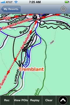 Tremblant: Gps Ski Maps - iPhone Ski App |
||||||||||||||||||||||||||||||
Tremblant users
| Ski Resort | Type | Info | Date |
|---|---|---|---|
| Tremblant | Track | 4 runs, max 22.75 m/s, avg 6.70 m/s, 7 green, 10 blue, 6 black, Tracked on App | Monday, February 2nd, 2015 |
| Tremblant | Track | 5 runs, max 20.0 m/s, avg 5.63 m/s, 8 green, 9 blue, 9 black, Tracked on App | Monday, February 2nd, 2015 |