|
Wolf Creek trail map is available as part of our USA/Canada Ski App. It is supported on iPhone / iPad, Android, Windows 8 Phone and Blackberry.
Wolf Creek Ski Area is a ski area in southwest Colorado, located on the Wolf Creek Pass between Pagosa Springs and South Fork. It is best known for receiving more average annual snowfall than any othe...(From Wikipedia page of Wolf Creek Ski Resort).
Want to know what others are saying about our app? Go here to see our reviews and coverage. This app is available as part of USA/Canada Ski App package to suit your skiing needs. Have more questions about the Ski App? Ask us.
|
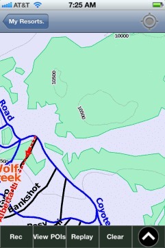 Wolf Creek: Gps Ski Maps - iPhone Ski App |
||||||||||||||||||||||||
Wolf Creek users
| Ski Resort | Type | Info | Date |
|---|---|---|---|
| Wolf Creek | Track | 22 runs, max 18.25 m/s, avg 1.76 m/s, 8 green, 75 blue, 13 black, Tracked on App | Friday, January 29th, 2016 |
| Wolf Creek | Track | 15 runs, max 14.0 m/s, avg 2.38 m/s, 16 green, 42 blue, 7 black, Tracked on App | Friday, January 29th, 2016 |
| Wolf Creek | Track | 11 runs, max 15.25 m/s, avg 2.07 m/s, 10 green, 33 blue, 4 black, Tracked on App | Friday, January 29th, 2016 |
| Wolf Creek | Track | 1 runs, max 0.0 m/s, avg 0.00 m/s, Tracked on App | Friday, January 29th, 2016 |