|
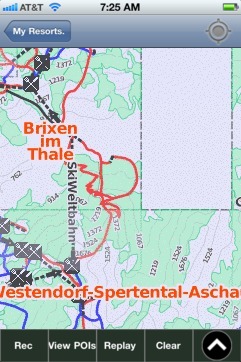
Ki-West/Wilder Kaiser-Brixental trail map is available as part of our Europe Ski App. It is supported on iPhone / iPad, Android, Windows 8 Phone and Blackberry. Ki-West/Wilder Kaiser-Brixental resort complex contains the following ski resorts: Soll, Westendorf-Spertental-Aschau, Brixen im Thale, Hopfgarten-Itter-Kelchsau, Scheffau, Ellmau-Going, Pass Thurn-Jochberg-Hollersbach, Kitzbuhel-Kirchberg-Gaisberg.
The Kaiser Mountains[1][2][3][4][5] (German: Kaisergebirge, lit. "Emperor Mountains") or just Kaiser, are a mountain range in the Northern Limestone Alps and Eastern Alps. It consists of two main moun...(From Wikipedia page of Ki-West/Wilder Kaiser-Brixental Ski Resort).
Want to know what others are saying about our app? Go here to see our reviews and coverage. This app is available as part of Europe Ski App package to suit your skiing needs. Have more questions about the Ski App? Ask us.
Other related Ski Resorts
|
 Ki-West/Wilder Kaiser-Brixental: Gps Ski Maps - iPhone Ski App
|
|||||||||||||||||