|
Schladming Dachstein trail map is available as part of our Europe Ski App. It is supported on iPhone / iPad, Android, Windows 8 Phone and Blackberry. Schladming Dachstein resort complex contains the following ski resorts: Fageralm, Reiteralm, Galsterbergalm, Rittisberg, Hauser Kaibling, Schladming-Planai-Hochwurzen, Dachsteingletscher, Stoderzinken.
Hoher Dachstein is a strongly karstic Austrian mountain, and the second highest mountain in the Northern Limestone Alps. It is situated at the border of Upper Austria and Styria in central Austria, an...(From Wikipedia page of Schladming Dachstein Ski Resort).
Want to know what others are saying about our app? Go here to see our reviews and coverage. This app is available as part of Europe Ski App package to suit your skiing needs. Have more questions about the Ski App? Ask us.
Other related Ski Resorts
|
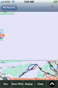 Schladming Dachstein: Gps Ski Maps - iPhone Ski App
|
|||||||||||||||||||||||||||||||||||||||||