Hochkonig Winterreich Ski App


Hochkonig Winterreich trail map is available as part of our Europe Ski App. It is supported on iPhone / iPad, Android, Windows 8 Phone and Blackberry.  

Hochkönig is the name applied to the highest mountain in the Berchtesgaden Alps, Salzburgerland, Austria, and also to the surrounding mountain group as a whole. The Berchtesgaden Alps form part of th...(From Wikipedia page of Hochkonig Winterreich Ski Resort).
 When you purchase our Ski App,  you get all the great ski app features, along with Hochkonig Winterreich gps ski map.


Want to know what others are saying about our app? Go here to see our reviews and coverage.

This app is available as part of  Europe Ski App package to suit your skiing needs.

Have more questions about the Ski App? Ask us.


Hochkonig Winterreich Ski Stats
Elevation2,941 m (9,649 ft)
Prominence2,181 m (7,156 ft)Ranked 6th in the Alps
ListingUltra
Translationhigh king (German)
PronunciationGerman: [ˈhoːxˌkøːnɪç]
LocationSalzburg, Austria
RangeBerchtesgaden Alps
Coordinates47°25′14.9″N 13°3′47.4″E / 47.420806°N 13.063167°E / 47.420806; 13.063167Coordinates: 47°25′14.9″N 13°3′47.4″E / 47.420806°N 13.063167°E / 47.420806; 13.063167
Topo mapBEV ÖK50 124; ÖAV 10/2
First ascent1826
Easiest routeHike


Other related Ski Resorts


Hochkonig Winterreich ski map - iPhone Ski App
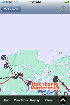
Hochkonig Winterreich: Gps Ski Maps - iPhone Ski App


Do you love boating? Checkout some charts from Marine / Lakes App.
II_DE_1W7D2240 - Don...
DE_1W7D2240 - Donau
II_DE_1W7D2230 - Don...